Shaping Liberty County's Future Through Smart Zoning Practices

Welcome to the Liberty Consolidated Planning Commission’s Zoning Department. Our mission is to serve the public, to protect our resources, and to guide growth in conformance with the Liberty Consolidated Comprehensive Plan and the Regional Plan of Coastal Georgia.

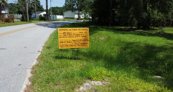
Zoning action pending sign by roadside.

Zoning and Land Use Assistance

We are able to help you with your zoning-related and land use questions for all of Liberty County, including all its municipalities. We can assist the public with small developments like placing a manufactured home in the correct location and, by the same token, help corporations or large landowners to rezone large tracts of land for planned unit developments or industrial parks. We work closely with all Liberty County Government Authorities and their staff. For our rezoning forms and other forms (e.g., conditional use, annexation, and variance) and submittal schedules and fees, please click here.

Land Development Administration and UDO Revisions

We administer the land development requirements in the Unified Development Ordinance (UDO), which includes provisions for zoning, signs, and subdivision. We also propose and prepare revisions to the UDO to respond to evolving developments in natural and urban environments and to keep pace with both federal laws and regulations as well as with State of Georgia laws and regulations.

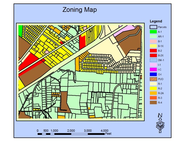
Zoning map with color-coded areas and legend.
Map of proposed overlay district guidelines.

Liberty County Overlay Districts and Design Guidelines

We are responsible for administering the design guidelines for various overlay district areas within Liberty County and its cities. Currently, there are six overlay districts as indicated below, and the provisions for them are found in the Unified Development Ordinance.

  • Liberty Gateway Overlay District includes portions of the East Oglethorpe Highway (US 84) and North and South Coastal Highway (US 17) corridors in Midway, Riceboro, and the unincorporated portion of the County
  • Hinesville Downtown Redevelopment Overlay District includes all of downtown Hinesville bounded by Oglethorpe Highway, General Screven Way, and General Stewart Way.
  • Flemington OC-1 Commercial Overlay District includes East Oglethorpe Highway within the city limits of Flemington.
  • Flemington Downtown Development Overlay District includes land south of East Oglethorpe Highway between Patriots Trail and Fraser Martin Avenue
  • Allenhurst Historical Overlay District includes portions of Dunlevie Road between the railroad tracks and Waters Avenue.
  • Military Installation Zoning Overlay District includes areas surrounding Fort Stewart.

Liberty County Overlay Districts and Design Guidelines

Additionally, we work in partnership with the City of Hinesville Department of Inspections and the Liberty County Building & Licensing Department, which issues building permits for all jurisdictions in Liberty County except for the City of Hinesville. For information on building permits, please visit, as applicable, the Liberty County website(opens in new tab) or the City of Hinesville website.(opens in new tab)

Contact icons cube on computer keyboard.
Liberty County Courthouse with columns and dome.

Liberty County – Unincorporated

Chairman, Liberty County Board of Commissioners: Donald L. Lovette

County Administrator: Joseph Mosley

Website: www.libertycountyga.gov(opens in new tab)

Board Meetings:

Date and Time—First Tuesday of each month at 6 p.m. and the third Thursday of each month at 5:00 p.m. unless otherwise announced.

Location—LC Courthouse Annex at 112 N Main Street, Hinesville.

For specific information, please consult the links below or contact Lori Parks.

Ordinances(opens in new tab)

Liberty County Building and Licensing Department(opens in new tab)

Liberty County Property Information System (PRISYM)(opens in new tab) for zoning districts, city limits, parcel information, FEMA flood maps, and National Wetland Inventory maps.

Hinesville business district with vintage cars.

City of Hinesville

Mayor: Karl Riles

City Manager: Ryan Arnold

City Clerk: Estella L. Roberson

Website: www.cityofhinesville.org(opens in new tab)

City Council meetings:

First and third Thursday of each month at 3:00 p.m. at City Hall, 115 E M.L. King, Jr. Drive, Hinesville. 

For specific information, please consult the links below or contact Sharon Cadiz.

Ordinances(opens in new tab)

Hinesville Department of Inspections(opens in new tab)

Liberty County Property Information System (PRISYM)(opens in new tab) for zoning districts, city limits, parcel information, FEMA flood maps, and National Wetlands Inventory maps.

Downtown Redevelopment Overlay District Design Review. The provisions of this overlay district are in the Unified Development Ordinance(opens in new tab). A map of the overlay district shows its boundaries and the 5 sub-(opens in new tab)areas, and it can also be found on the Hinesville GIS property identifier map(opens in new tab). Development in the downtown may require design review in accordance with the design guidelines(opens in new tab). There are two design review checklists—one for the historic urban core and one for the other sub-areas(opens in new tab). For additional information, please email Mardee Sanchez.

Flemington City Hall sign and building exterior.

City of Flemington

Mayor: Tim Byler

City Clerk: Shameka Hawkes

Website: cityofflemington.org(opens in new tab)

City Council meetings:

Date and Time—Second Tuesday of each month at 4:30 p.m. unless otherwise announced

Location—City Hall at 156 Old Sunbury Road, Flemington

For specific information, please consult the links below or contact Sharon Cadiz.

Ordinances(opens in new tab)

Flemington Business License Application form—please call the City of Flemington (912) 877-3223.

Liberty County Building and Licensing Department(opens in new tab)

Liberty County Property Information System (PRISYM)(opens in new tab) for zoning districts, city limits, parcel information, FEMA flood maps, and National Wetlands Inventory maps.

Cottage surrounded by trees and pink flowers.

City of Midway

Mayor: Malcolm X. Williams

City Clerk: Lynette Cook-Osborne

Website: www.historicmidway.com(opens in new tab)

City Council meetings:

Date and Time—Second Monday of each month at 6:00 PM. unless otherwise announced. There is also a workshop meeting on the fourth Monday of each month at 9:00 AM.

Location—Midway City Hall Multi-Complex, 41 Charlie Butler Road, Midway.

For specific information or for ordinance information, please consult the links below or contact Sharon Cadiz.

 Midway Business License Application form—please contact the City of Midway at (912) 884-3344.

Ordinances(opens in new tab)

County Building and Licensing Department(opens in new tab)

Liberty County Property Information System (PRISYM)(opens in new tab) for zoning districts, city limits, parcel information, FEMA flood maps, and National Wetlands Inventory maps.

Historic brick building with wooden porch.

City of Walthourville

Historical marker for Riceborough, Georgia.

City of Riceboro

Mayor: Christopher Stacy

City Clerk: Malinda McIver

Website: www.cityofriceboro.com(opens in new tab)

City Council meetings:

Date and Time—First Tuesday of each month at 6:00 PM. unless otherwise announced

Location—Riceboro City Hall at 4614 S Coastal Hwy 17

For specific information, please consult the links below or contact Lori Parks.

Ordinances(opens in new tab)

Riceboro Business License Application form—please contact the City of Riceboro (912) 884-2986.

County Building and Licensing Department(opens in new tab)

Liberty County Property Information System (PRISYM)(opens in new tab) for zoning districts, city limits, parcel information, FEMA flood maps, and National Wetlands Inventory maps.

Yellow building surrounded by trees and pathway.

Town of Allenhurst

City of Gum Branch

Fire station with American flag and trucks.